Ho Chi Minh trail: Difference between revisions
Jump to navigation
Jump to search

imported>Eric Clevinger No edit summary |
mNo edit summary |
||
| (3 intermediate revisions by 3 users not shown) | |||
| Line 1: | Line 1: | ||
{{subpages}} | {{subpages}} | ||
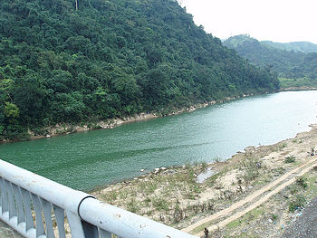
{{Image|HoChiMinhTrail DrakongBridge.jpg|right|350px|A view from the Dakrong Bridge, the start of the Ho chi Minh Trail.}} | {{Image|HoChiMinhTrail DrakongBridge.jpg|right|350px|A view from the Dakrong Bridge, the start of the Ho chi Minh Trail.}} | ||
The '''Ho Chi Minh Trail''' was the name given to a complex multi-route means of conveying troops, arms and supplies from North to South Vietnam during the [[Vietnam War]]. The routes were mostly mountain and jungle paths which went through Laos and Cambodia. The trail was first mapped out in 1959 following the decision by North Vietnam to use guerilla warfare in its campaign to unify the two Vietnamese states. | |||
==References== | |||
{{reflist}} | |||
[[Category:Reviewed Passed if Improved]][[Category:Suggestion Bot Tag]] | |||
Latest revision as of 17:00, 28 August 2024
The Ho Chi Minh Trail was the name given to a complex multi-route means of conveying troops, arms and supplies from North to South Vietnam during the Vietnam War. The routes were mostly mountain and jungle paths which went through Laos and Cambodia. The trail was first mapped out in 1959 following the decision by North Vietnam to use guerilla warfare in its campaign to unify the two Vietnamese states.
